
Zubiri → Pamplona
Updated on 19 November 2026 by the Buen Camino Santiago team
Stage map
Start in green, finish in red and villages along the way in yellow, in order by kilometre.
Towns and services
| Town | Km | ATM | Pharmacy | Shop | Bar/Rest. | Bed | Health | Notes |
|---|---|---|---|---|---|---|---|---|
| Zubiri | 0 | ✓ | ✓ | ✓ | ✓ | ✓ | · | Start. The Puente de la Rabia over the Arga. Basic services. |
| Larrasoaña | ~5,5 | · | · | ✓ | ✓ | ✓ | · | A village with a strong Camino tradition; the Puente de los Bandidos. Albergues, shop and bar. |
| Zuriáin | ~9 | · | · | · | ✓ | ✓ | · | Hamlet beside the Arga. Albergue and bar (La Parada). Watch out for the slippery descent just before. |
| Irotz | ~11 | · | · | · | ✓ | · | · | Church of San Pedro and the Romanesque bridge of Iturgaiz. Bar-restaurant (El Horno de Irotz). |
| Zabaldika | ~12 | · | · | · | · | ✓ | · | Church of San Esteban (13th century), on the historic route. Parish albergue. |
| Trinidad de Arre | ~15,8 | · | · | · | ✓ | ✓ | · | The medieval bridge and the pilgrim basilica-hospital. The Camino Baztanés joins here. Albergue. |
| Villava | ~16,1 | ✓ | ✓ | ✓ | ✓ | ✓ | · | Birthplace of Miguel Induráin. The San Andrés mill. All services and albergue. |
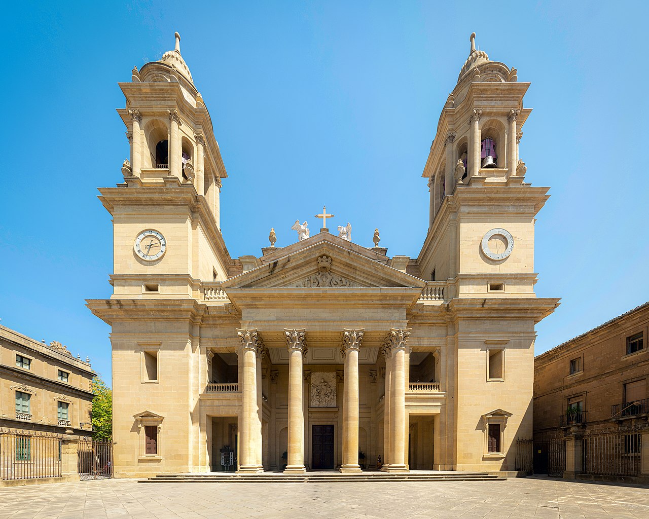
| Pamplona | ~21 | ✓ | ✓ | ✓ | ✓ | ✓ | ✓ | Finish. The cathedral, the city walls and Calle Estafeta of the San Fermín festival. All services. |
✓ available · · not available. Approximate distances from the start. In the low season some bars may close.
What to see
- Pamplona/Iruña. The first big city on the Camino, entered over the medieval Puente de la Magdalena and through the Portal de Francia, in its magnificent walls. Don’t miss the Gothic cathedral of Santa María la Real and its cloister, the bastioned walls and the Citadel, the Plaza del Castillo and Calle Estafeta, the heart of the San Fermín bull run.
- The Trinidad de Arre. One of the most evocative spots of the stage: a six-arched medieval bridge over the Ultzama river leading to the Romanesque basilica and the old pilgrim hospital (now an albergue), where the Camino Baztanés (from Bayonne) joins the Camino Francés.
- Larrasoaña. A village with a deep Camino tradition, shaped by medieval French settlers, with its houses bearing coats of arms, the parish church of San Nicolás de Bari and its medieval bridge (the “Bandits’ Bridge”).
- Zabaldika and its church of San Esteban (13th century). On the historic route, an open church with one of the oldest bells in Navarre and a warm parish welcome; the reward for choosing the traditional route over the riverside alternative.
- Villava. The birthplace of cyclist Miguel Induráin, five-time winner of the Tour de France, with his monument and the 16th-century San Andrés mill.
- The Puente de la Magdalena. The medieval bridge over the Arga by which pilgrims enter Pamplona, a sister of the famous bridge at Puente la Reina.
Elevation profile
Approximate elevation profile. In the stage data, elevation marked with ~ is an estimate; without ~, it is verified data.
Route: Rutas de Caminos de Santiago 2020-2026, CC BY 4.0 FEAACS. Split into stages by BuenCaminoSantiago.com
Tips and warnings
- Easy and downhill, but with a couple of warnings: watch out on the descent to the Arga before Zuriáin, slippery and steep (dangerous in the rain), and on the awkward stretch along the hard shoulder of the N-135.
- Choose the historic route via Arleta and Zabaldika. Although the riverside alternative (towards Huarte) is pleasant and flat, it is not the original route and you miss the church of Zabaldika and the bridge at the Trinidad de Arre. For a few short climbs, the historic route is worth it.
- The last ~5 km are urban: after the Trinidad de Arre, Villava, Burlada and Pamplona follow one another. The waymarking is set in the pavement; follow the shells and arrows.
- Don’t feel you have “arrived” in Villava: there are still ~5 km to Pamplona’s old town.
- Stocking up is easy: there are villages with a bar or albergue every few kilometres (Larrasoaña, Zuriáin, Irotz), although some may be closed out of season.
- Give Pamplona some time: enter through the Portal de Francia, walk the walls and visit the cathedral, and lose yourself in Calle Estafeta and the Plaza del Castillo.
Useful links
The Zubiri – Pamplona stage is stage 3 of the Camino Francés: 20.4 km with 231 m of total ascent and 314 m of descent, about 4.5 hours of walking. Its difficulty is 2 out of 5 and its scenery 3 out of 5.

Contents
Zubiri – Pamplona stage: key facts
- Distance: 20.4 km
- Elevation: 231 m of ascent and 314 m of descent
- Duration: about 4.5 hours
- Highest point: 573 m
- Surface: 47% on asphalt, concrete or streets; 13% on roads with traffic
- Longest section without a fountain, bar or shop: 3 km
- Longest section without accommodation: 6.8 km
- Distance to Santiago from Zubiri: 718.1 km
From Zubiri to Pamplona, step by step
The Camino Francés stage between Zubiri and Pamplona runs along the Esteribar valley before entering the basin of the Navarrese capital. From the Puente de la Rabia, the route links small hamlets such as Ilarratz and Ezkirotz, reaches historic Larrasoaña and continues through Akerreta, Zuriain and Irotz. The Romanesque bridge of Iturgaiz, the Trinidad de Arre and the Pamplona District River Park provide some of the most attractive moments of the day.
Then the Camino crosses Villava and Burlada before reaching the medieval Magdalena bridge and entering the old town through the Portal de Francia. It is a stage of medium difficulty, 20.26 kilometres long with a rolling profile, gentler than the Pyrenean days but with enough short climbs and stony sections to keep you alert.
The abundance of services in the second half makes planning easy, while Pamplona offers one of the stage finishes with the richest monuments, food and culture on the whole Camino Francés.
From Zubiri to Pamplona, 20.4 km. A stage with gentle ups and downs: 231 m of total ascent and 314 m of descent; the highest point is at 573 m. It passes Ilarratz, Larrasoaña, Akerreta, Zuriaín, Irotz and 3 more places.
47% is on asphalt, concrete or streets and 13% on roads with traffic; the rest on dirt tracks and paths. Water and bars are well spread out: the longest section without a fountain, bar or shop is 3 km.
There is accommodation in 7 of the 9 places on the stage (not counting the start); the longest section with nowhere to sleep is 6.8 km. Difficulty 2 out of 5 and scenery 3 out of 5.
| Place | Km from Zubiri | Km to Santiago | Places to stay | Services |
|---|---|---|---|---|
| Zubiri | 0 | 718.1 | 13 | all services |
| Ilarratz | 2.8 | 715.3 | 0 | — |
| Urdániz | 1 | restaurant | ||
| Larrasoaña | 5.5 | 712.6 | 3 | bar, restaurant, shop |
| Akerreta | 6.1 | 712 | 1 | — |
| Zuriaín | 9.2 | 708.9 | 1 | bar, restaurant |
| Irotz | 11.3 | 706.8 | 0 | — |
| Zabaldika | 1 | — | ||
| Huarte | 1 | all services | ||
| Trinidad de Arre | 16 | 702.1 | 1 | — |
| Villava/Atarrabia | 16.4 | 701.7 | 3 | all services |
| Burlada | 17.5 | 700.6 | 3 | all services |
| Pamplona/Iruña | 20.4 | 697.7 | 27 | all services |


Stage 3 elevation profile
The day leaves Zubiri beside the Arga and keeps a descending, rolling profile for much of the day. The first kilometres alternate paved paths and short climbs towards Ilarratz, Ezkirotz and Larrasoaña. After Akerreta you descend into the valley again to walk near the river through Zuriain and Irotz. The route includes short, continuous climbs, but no long pass.
After the Iturgaiz bridge, the Camino approaches the Pamplona basin and joins the River Park as far as the Trinidad de Arre. From Villava and Burlada the profile becomes virtually flat and urban. The trickiest point is not the gradient but the combination of uneven surfaces, possible wet areas and the traffic crossings in the final part.
The entry over the Magdalena bridge and through the Portal de Francia makes for a monumental and very recognisable finish.
Terrain and surface
Dirt tracks and paths with short climbs, and asphalted town streets on the way out of Zubiri and into Pamplona / Iruña.
What to see on stage 3 of the Camino Francés
- Bridge of la Rabia (Zubiri). Must-see.
- Bridge of los Bandidos (Larrasoaña). 14th century. Must-see.
- Church of San Nicolás de Bari (Larrasoaña). 13th century. Must-see.
- Romanesque-Gothic church of San Esteban (Zabaldika). Must-see.
- Basilica of la Trinidad de Arre (Trinidad de Arre). Must-see.
- Pamplona Cathedral (Pamplona/Iruña). Gothic and Neoclassical Catholic cathedral, 14th century. Protection: Bien de Interés Cultural (Spanish heritage listing). Not to be missed.
- Palace of los Reyes de Navarra (Pamplona/Iruña). Palace, 14th–15th century. Protection: Bien de Interés Cultural (Spanish heritage listing). Must-see.
- Church of San Lorenzo (Pamplona/Iruña). Baroque church. Protection: Bien de Interés Cultural (Navarre). Not to be missed.
- Bridge of la Magdalena (Pamplona/Iruña). Must-see.
- Churches of San Cernín (Pamplona/Iruña). 13th century. Must-see.
Where to sleep in Pamplona
Pamplona has 27 places to stay in our guide. Public albergues: Jesús y María municipal albergue (112 beds, €12); Casa Paderborn pilgrim albergue (26 beds, €9.50). All of them, with price, beds and contact details, in the Pamplona accommodation finder.
Weather and daylight hours in Pamplona
Average temperatures from the Pamplona, Aeropuerto weather station (1981–2010), the nearest to Pamplona, and sunrise and sunset times.
| Month | High (°C) | Low (°C) | Sunrise | Sunset |
|---|---|---|---|---|
| January | 9.1 | 1.4 | 08:34 | 17:57 |
| February | 10.9 | 1.6 | 08:04 | 18:37 |
| March | 14.6 | 3.7 | 07:19 | 19:12 |
| April | 16.4 | 5.3 | 07:25 | 20:48 |
| May | 20.8 | 8.6 | 06:44 | 21:21 |
| June | 25.2 | 11.9 | 06:27 | 21:46 |
| July | 28.2 | 14.2 | 06:41 | 21:43 |
| August | 28.3 | 14.5 | 07:12 | 21:08 |
| September | 24.5 | 12 | 07:46 | 20:16 |
| October | 19.3 | 8.9 | 08:19 | 19:24 |
| November | 13.1 | 4.8 | 07:58 | 17:43 |
| December | 9.7 | 2.2 | 08:30 | 17:32 |
The stage with a pet or by bike
In Pamplona there is 1 place to stay that accepts pets. 7 places to stay store bicycles.
The weather in Pamplona
Loading the weather…
Data: Open-Meteo · 3-day forecast, for guidance only.