
Camino de Arles
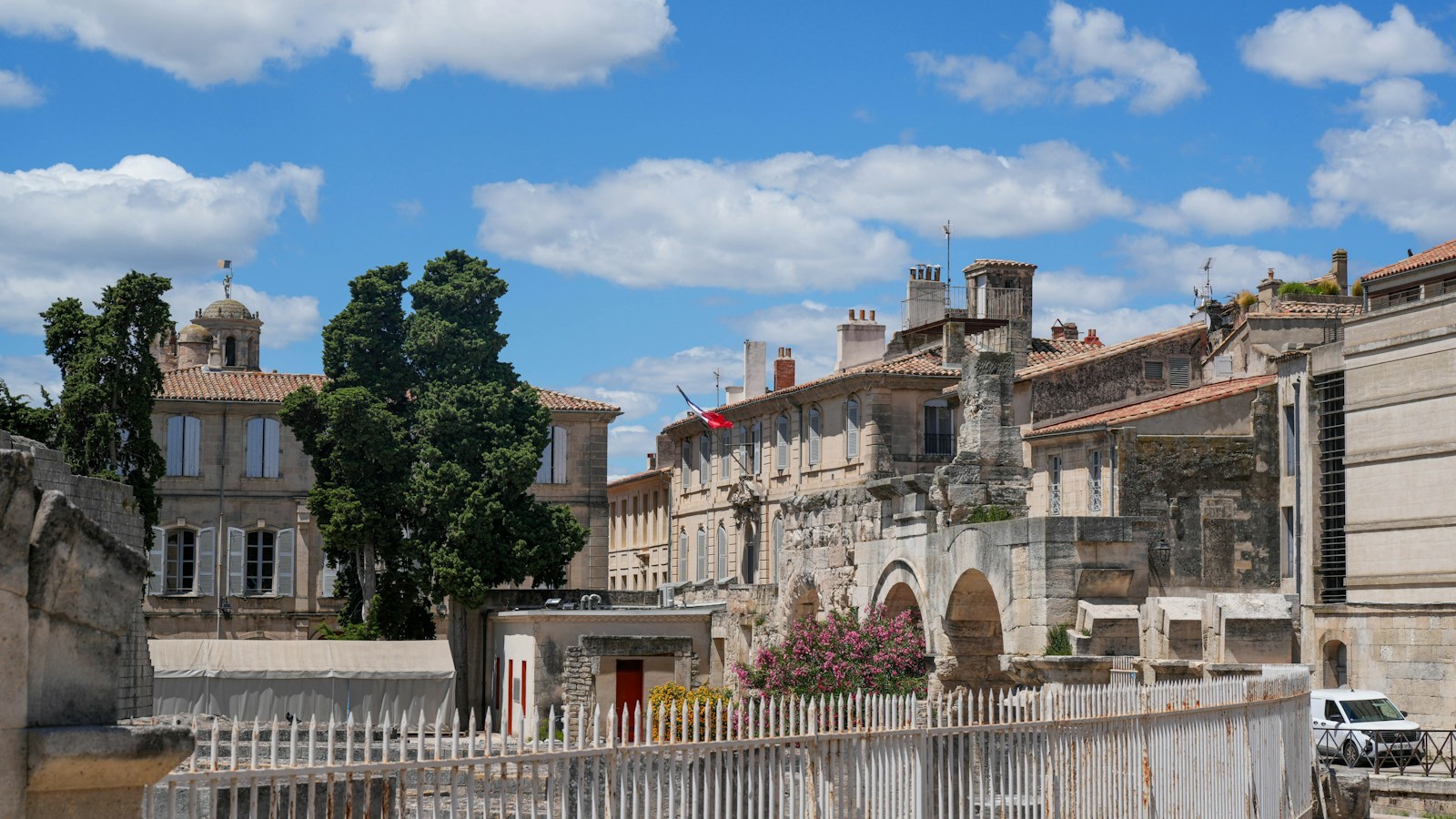
The Camino de Arles, the Via Tolosana or GR 653, leaves Arles, in Provence, crosses the Languedoc via Montpellier, Saint-Guilhem-le-Désert and Castres, passes through Toulouse and Auch and climbs the Aspe valley to the Somport pass, where the Camino Aragonés begins. It covers 782.3 km in 33 stages, and about 1,618 km to Santiago.
It is the route of pilgrims from Italy and southern France, with 504 places to stay and 121 albergues or gîtes, at an average of €23.80 per bed. In this guide you have the map, the stages, the variants, what to see, when to go, how to get there and where to sleep.
- The stages
- Key facts
- Stages by section
- The variants
- What to see
- When to go
- Getting there
- From Somport to Santiago
- Where to sleep
- Tips
- Credential and Compostela
- FAQ
The stages of the Camino de Arles
The map shows the route from Arles to Somport and below it all the stages, including those of the variants. Tap one to see its route, the villages, what to see and where to sleep.
Tap a point to see the stage; zoom in to see the numbers. On mobile, tap the map to move it. Route: © OpenStreetMap contributors (ODbL).
Easy Moderate Hard
Camino de Arles key facts
| Fact | Arles Route |
|---|---|
| Route | Arles › Somport (782.3 km in 33 stages) |
| To Santiago | about 1,618 km from Arles, continuing along the Aragonés and Francés routes |
| Variants | Along the Canal du Midi between Baziège and Toulouse (24.9 km) |
| Average per stage | 23.7 km; the longest, 34 km |
| Total ascent | About 13,259 m |
| Highest point | 1632 m |
| Places to stay | 504 listed, 121 of them albergues (27 public, with 1,328 beds) |
| Albergue bed | €23.80 on average; double room, €78 |
| Asphalt or paved | 51% of the route; 14% on roads with traffic |
| Longest section without a fountain, bar or shop | 27.9 km |
| Longest section without accommodation | 29.3 km |
| Medium difficulty | 2.5 out of 5 |
| Backpack transfer with Correos | Not available on this route |
The stages of the Camino de Arles by section
From Arles to Montpellier: 4 stages and 90.9 km
It leaves Arles across the Camargue to Saint-Gilles, with its abbey, and continues via Gallargues-le-Montueux and Vendargues to Montpellier.
From Montpellier to Castres: 11 stages and 233.9 km
It climbs to Saint-Guilhem-le-Désert, with the abbey of Gellone, and crosses the mountains of the Haut-Languedoc via Lodève, Lunas, Saint-Gervais-sur-Mare, Murat-sur-Vèbre and La Salvetat-sur-Agout, before descending to Castres.
From Castres to Toulouse: 5 stages and 141.1 km
Via Dourgne and the Lauragais, Les Cassés and Avignonet-Lauragais, the path reaches Baziège and Toulouse, on the GR 653 or along the Canal du Midi.
From Toulouse to Somport: 13 stages and 316.4 km
From Toulouse it crosses the Gers via L’Isle-Arné and Auch, with its cathedral, and Marciac, enters the Béarn via Morlaàs and Lescar and reaches Oloron-Sainte-Marie. The last stages climb the Aspe valley via Sarrance and Borce to the Somport pass, at 1,632 m.
The variants of the Camino de Arles
- Canal du Midi variant: Baziège › Toulouse, 24.9 km along the canal towpath, instead of the 33.6 km of the GR 653.
What to see on the Camino de Arles
These are the places you should not miss:
- Alyscamps, in Arles (classified historic monument)
- Church of St-Théodorit, in Vendargues
- Historic ensemble of Saint-Guilhem, in Saint-Guilhem-le-Désert
- Église Saint-Pancrace de Lunas, in Lunas (registered historic monument)
- Remains of the medieval enclosure and castle, in La Salvetat-sur-Agout
- Cathedral of Saint-Benoît, in Castres (classified historic monument)
- Remains of the Poor Clares convent, in Les Cassés
- Basilica of Saint-Sernin, in Toulouse (part of a World Heritage Site)
- Mill, in L'Isle-Arné
- Bastide with the great square, in Marciac
- Cathedral of Sainte-Marie d'Oloron, in Oloron-Sainte-Marie (part of a World Heritage Site)
- Église Saint-Grat d'Etsaut, in Etsaut (listed in the General Inventory of Cultural Heritage)
When to walk the Camino de Arles
The best time is April to June and September to October. In summer it is hot in Provence and the Languedoc, and in winter the Somport pass has snow. The average high on the route is 27.8 °C in July and 28 °C in August, and the average low in January, 1.8 °C. Of the 121 albergues with opening dates, 67 are open in January, 115 in May and 114 in August.
| Month | Average high | Average low | Rainy days | Albergues open |
|---|---|---|---|---|
| January | 9.9 °C | 1.8 °C | 10.3 | 67 of 121 |
| February | 11.2 °C | 1.8 °C | 8.7 | 72 of 121 |
| March | 14.8 °C | 4.2 °C | 8.9 | 89 of 121 |
| April | 17.3 °C | 6.6 °C | 10.2 | 113 of 121 |
| May | 21.2 °C | 10.1 °C | 9.8 | 115 of 121 |
| June | 25.3 °C | 13.6 °C | 7.5 | 116 of 121 |
| July | 27.8 °C | 15.5 °C | 6.2 | 114 of 121 |
| August | 28 °C | 15.5 °C | 6.4 | 114 of 121 |
| September | 24 °C | 12.2 °C | 7.4 | 114 of 121 |
| October | 19.3 °C | 9.5 °C | 9.3 | 113 of 121 |
| November | 13.5 °C | 5.2 °C | 10.7 | 81 of 121 |
| December | 10.6 °C | 2.5 °C | 9.9 | 73 of 121 |
Temperatures and rain: route averages, using the normals from the weather station closest to each stage end. Open albergues: our own analysis of each albergue's opening dates.
How to get to Arles to start the Camino de Arles
No direct connection from Madrid; travel via Barcelona or fly to the south of France.
You can also start in Montpellier or Toulouse. With the planner you choose the starting point and the days you have.
From Somport to Santiago
At the Somport pass the Camino Aragonés begins, descending to Jaca and continuing via Sangüesa to Puente la Reina, where it joins the Camino Francés. The next stage is Somport › Jaca.
Where to sleep on the Camino de Arles
We have 504 places to stay listed on the Camino de Arles, including 121 albergues, 27 of them public. An albergue bed costs €23.80 on average and a double room €78.
This table shows what there is at each stage end. The accommodation finder for the Camino de Arles has them all, with price, phone number and website.
| Stage | Stage end | Albergues | Bed from | Other accommodation |
|---|---|---|---|---|
| 1 | Saint-Gilles | 1 (1 pub.) | 15 € | 7 |
| 2 | Gallargues-le-Montueux | 0 | — | 9 |
| 3 | Vendargues | 0 | — | 9 |
| 4 | Montpellier | 3 | 29 € | 17 |
| 5 | Montarnaud | 1 | 20 € | 3 |
| 6 | Saint-Guilhem-le-Désert | 1 | 15 € | 6 |
| 7 | Saint-Jean-de-la-Blaquière | 0 | — | 3 |
| 8 | Lodève | 1 | — | 8 |
| 9 | Lunas | 0 | — | 4 |
| 10 | Saint-Gervais-sur-Mare | 0 | — | 8 |
| 11 | Murat-sur-Vèbre | 0 | — | 5 |
| 12 | La Salvetat-sur-Agout | 0 | — | 3 |
| 13 | Anglès | 0 | — | 5 |
| 14 | Boissezon | 0 | — | 6 |
| 15 | Castres | 4 | Donation | 13 |
| 16 | Dourgne | 2 | 30 € | 6 |
| 17 | Les Cassés | 0 | — | 1 |
| 18 | Avignonet-Lauragais | 0 | — | 6 |
| 19 | Baziège | 0 | — | 2 |
| 20 | Toulouse | 3 | 30 € | 22 |
| 21 | Léguevin | 1 (1 pub.) | 10 € | 2 |
| 22 | Giscaro | 0 | — | 1 |
| 23 | L'Isle-Arné | 1 | — | 1 |
| 24 | Auch | 2 | Donation | 9 |
| 25 | L'Isle-de-Noé | 0 | — | 1 |
| 26 | Marciac | 0 | — | 9 |
| 27 | Vidouze | 0 | — | 0 |
| 28 | Morlaàs | 0 | — | 6 |
| 29 | Lescar | 1 (1 pub.) | 12 € | 7 |
| 30 | Oloron-Sainte-Marie | 1 (1 pub.) | 15 € | 11 |
| 31 | Sarrance | 1 | 30 € | 1 |
| 32 | Borce | 1 | 20 € | 3 |
| 33 | Somport | 1 | 30 € | 0 |
Indicative prices of the cheapest albergue bed; "—" means we do not have the price. Always phone the day before.
Tips for the Camino de Arles
- Prepare for the climb to Somport. The last stages climb more than 1,000 m up the Aspe valley: check the weather, especially outside summer.
- Watch the long stages. 6 stages are over 30 km. Use the planner to split the route into days that suit you.
- Carry water. The longest stretches without a fountain, bar or shop are 27.9 km on Vidouze › Morlaàs; 24.6 km on L'Isle-de-Noé › Marciac; 24.5 km on Lunas › Saint-Gervais-sur-Mare.
- Phone the albergues ahead, especially out of season.
- Count the daylight hours. In January there are about 9.3 hours of daylight a day and in June, up to 15.4.
- There is no Correos backpack transport on this route. Travel light.
- Prepare the trip with our guides to the first-aid kit, useful apps and what to pack.
Credential and Compostela
The credencial is the document that identifies you as a pilgrim: it gives access to the albergues and is the proof you need to request the Compostela. The official model is issued by the Pilgrimage Office of Santiago Cathedral and can be obtained from parishes, Friends of the Camino associations, albergues and authorised confraternities. More details in our guide to the pilgrim credencial.
For the Compostela you must walk at least the last 100 consecutive km to Santiago (200 km by bike), getting your credencial stamped twice a day on that stretch. Continuing along the Aragonés and Francés routes, the nearest qualifying start is A Pena (Paradela), 100 km away. It is collected in person at the Pilgrim Office.
Camino de Arles FAQ
How many kilometres is the Camino de Arles?
782.3 km from Arles to Somport in 33 stages. To Santiago: about 1,618 km from Arles, continuing along the Aragonés and Francés routes.
How many days does it take to walk the Camino de Arles?
33 days from Arles to Somport, at an average of 23.7 km a day. With the planner you can spread it over the days you have.
Which is the longest stage of the Camino de Arles?
The one from Dourgne to Les Cassés, with 34 km.
Are there albergues on the Camino de Arles?
Yes: 121 albergues, 27 of them public, at an average of €23.80 per bed. You will find them in the accommodation finder.
What is the Via Tolosana?
It is the Latin name of the Camino de Arles, which passes through Toulouse (Tolosa), waymarked as the GR 653.
Where does the Camino de Arles end?
At the Somport pass, where the Camino Aragonés begins.
Plan your days with the planner and, from Somport, continue along the Camino Aragonés. To prepare the trip see the practical guides to the Camino de Santiago or compare other routes in all the Caminos.