
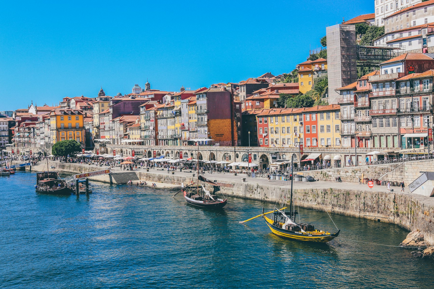
Portuguese Coastal Way (Camino Portugués de la Costa)
The Portuguese Coastal Way (Camino Portugués de la Costa) leaves Porto and follows the Atlantic coast via Póvoa de Varzim, Viana do Castelo and Caminha; it crosses the Miño, enters Galicia and passes Baiona and Vigo until it joins the Central Portuguese Camino at Redondela. To Santiago it is 272.6 km in 13 stages. In 2025, 89,503 pilgrims reached Santiago on this route.
This Portuguese Coastal Way guide has the key facts, the stages by section and one by one, the variants, when to go month by month, how to get to Porto, where to sleep, what to eat and how to get the credential and the Compostela. Further down you’ll find the 13 stages with their map, elevation profile and accommodation.
- The 13 stages
- Key facts
- Stages by section
- Stage by stage
- Variants
- Coastal or Central?
- When to go
- Getting there
- Where to sleep
- What to eat
- Credential and Compostela
- FAQ
The 13 stages of the Portuguese Coastal Way
The map shows the whole route and below it each stage with its start, finish and distance. Tap one to see its elevation profile, the villages along the way and where to sleep.
Tap a point to see the stage; zoom in to see the numbers. On mobile, tap the map to move it. Route: © OpenStreetMap contributors (ODbL).
Easy Moderate Hard
Portuguese Coastal Way: key facts
| Fact | Portuguese Coastal Way |
|---|---|
| Route | Porto › Redondela › Santiago de Compostela |
| Distance | 272.6 km; 187.9 km to Redondela |
| Stages | 13 (average 21 km); 9 to Redondela |
| Total ascent | About 3,192 m; 1,981 m to Redondela |
| Highest point before Redondela | 188 m |
| Albergues before Redondela | 64 (15 public); 38 open all year |
| Albergue bed | €19.70 on average; about €260 for the 13 stages |
| Asphalt or paved before Redondela | 65% of the route |
| Longest section without a fountain, bar or shop | 7 km |
| Minimum for the Compostela | The last 100 km; from Vigo there are about 100 km left |
| Backpack transfer with Correos | From A Guarda, March to October (also from Porto) |
| Pilgrims in 2025 | 89,503 |
The stages of the Portuguese Coastal Way by section
The Portuguese Coastal Way has three parts: the coast of northern Portugal to the Miño, the Galician coast to Vigo and Redondela, and the final section to Santiago, shared with the Central route. It is a route with little climbing: only one stage is rated as hard.
| Section | From › to | Stages | Km | Ascent (m) |
|---|---|---|---|---|
| Porto to Caminha | Porto › Caminha | 1–5 | 110.6 | 857 |
| Caminha to Redondela | Caminha › Redondela | 6–9 | 77.3 | 1,124 |
| Redondela to Santiago | Redondela › Santiago de Compostela | 10–13 | 83.9 | 1,211 |
Porto to Caminha: 5 stages and 110.6 km
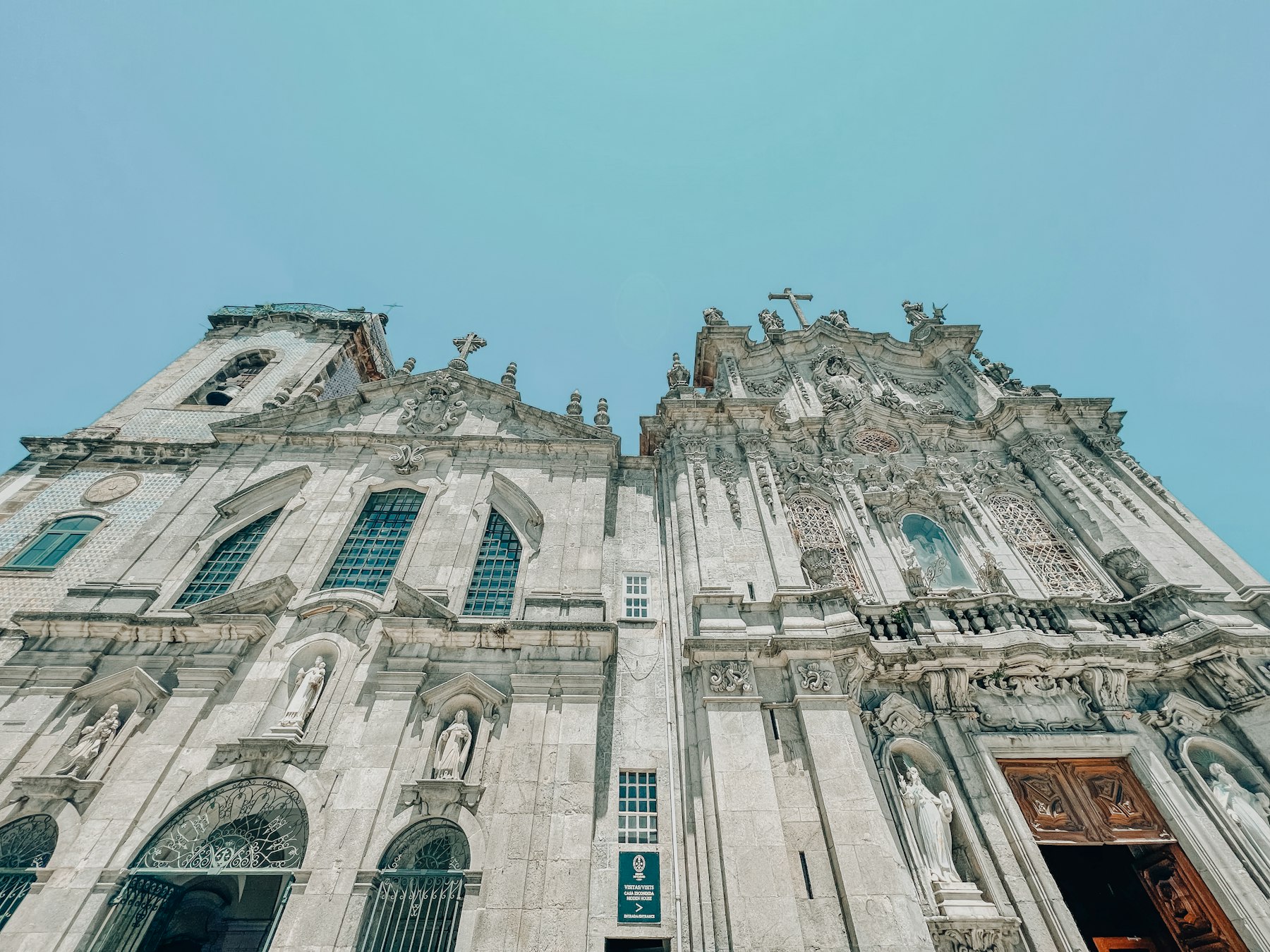
It leaves Porto, by the Douro, and climbs up the coast of northern Portugal: Labruge, Póvoa de Varzim, Marinhas and Viana do Castelo to Caminha, facing the Miño. The first three stages add up to barely 252 m of ascent. The only hard stage of the whole route is Viana do Castelo to Caminha: 26.8 km and 318 m of ascent. On the first stage, at Angeiras beach, there is a curious National Monument: a set of tanks carved into the rocks. See the Viana do Castelo › Caminha stage.
Caminha to Redondela: 4 stages and 77.3 km
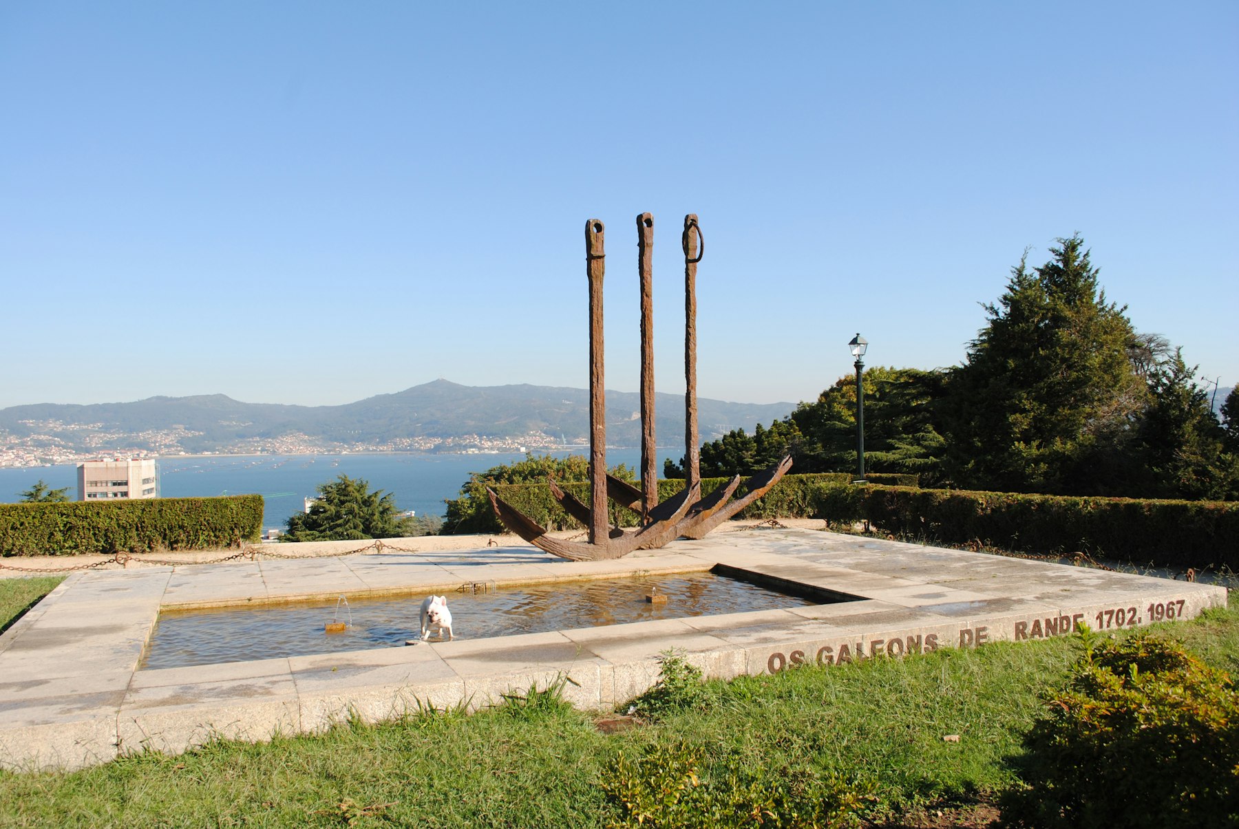
After crossing the Miño, the Camino enters Galicia at A Guarda and follows the Oia coast to Porto Mougás; then come Baiona and Cape Silleiro, A Ramallosa and Vigo. From Vigo, the Senda da Traída leads to Redondela, where it joins the Central route. The stage with the most climbing in this section is A Ramallosa to Vigo: 21.5 km and 363 m. See the A Ramallosa › Vigo stage.
Redondela to Santiago: 4 stages and 83.9 km
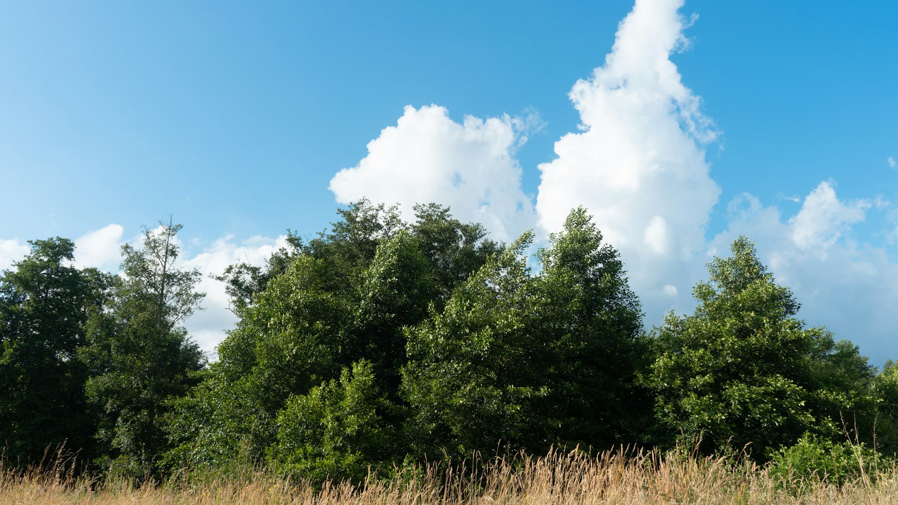
From Redondela the route is the same as the Central Portuguese Camino: Pontevedra, Caldas de Reis, Padrón and Santiago. These are four moderate stages, between 18.6 and 24.4 km; between Pontevedra and Padrón you can take the Spiritual Variant. See the Redondela › Pontevedra stage.
The Portuguese Coastal Way stage by stage
The distance, ascent and difficulty of each stage of the Portuguese Coastal Way, as shown on its page. Tap the name to see the map, the elevation profile and the accommodation.
| Stage | From › to | Km | Ascent (m) | Difficulty |
|---|---|---|---|---|
| 1 | Porto › Labruge | 24.5 | 96 | Easy |
| 2 | Labruge › Póvoa de Varzim | 14 | 63 | Moderate |
| 3 | Póvoa de Varzim › Marinhas | 24.5 | 93 | Moderate |
| 4 | Marinhas › Viana do Castelo | 20.8 | 287 | Moderate |
| 5 | Viana do Castelo › Caminha | 26.8 | 318 | Hard |
| 6 | Caminha › Porto Mougás | 23.5 | 300 | Moderate |
| 7 | Porto Mougás › A Ramallosa | 16 | 248 | Moderate |
| 8 | A Ramallosa › Vigo | 21.5 | 363 | Moderate |
| 9 | Vigo › Redondela | 15.4 | 213 | Moderate |
| 10 | Redondela › Pontevedra | 19.8 | 401 | Moderate |
| 11 | Pontevedra › Caldas de Reis | 21.1 | 218 | Moderate |
| 12 | Caldas de Reis › Padrón | 18.6 | 187 | Moderate |
| 13 | Padrón › Santiago de Compostela | 24.4 | 405 | Moderate |
- Stage 2, Labruge › Póvoa de Varzim: The shortest stage of the route, at 14 km and only 63 m of ascent.
- Stage 5, Viana do Castelo › Caminha: The only hard one: 26.8 km and 318 m of ascent to reach Caminha, facing the Miño.
- Stage 6, Caminha › Porto Mougás: The stage that crosses the Miño and follows the Oia coast, already in Galicia.
- Stage 7, Porto Mougás › A Ramallosa: Via Baiona and Cape Silleiro to A Ramallosa, in 16 km.
- Stage 8, A Ramallosa › Vigo: It has an official route and a coastal alternative of almost the same distance.
- Stage 9, Vigo › Redondela: Along the Senda da Traída to Redondela, where the Central route joins.
- Stage 13, Padrón › Santiago de Compostela: The arrival in Santiago, with 405 m of ascent, the most on the route.
Variants of the Portuguese Coastal Way
- Link to the Central route via Tui: from Caminha you can walk to Tui, 32 km, and continue from there on the Central Portuguese Camino.
- Along the coast between A Ramallosa and Vigo: a seaside alternative of 21.7 km, almost the same distance as the official route.
- Spiritual Variant: between Pontevedra and Padrón, three stages via A Armenteira and Vilanova de Arousa, with 78.9 km.
Portuguese Coastal Way or Central?
Both start in Porto and finish together from Redondela. The Coastal route is longer, about 28.6 km more, but has much less climbing and slightly milder temperatures in summer; the Central route is shorter and busier, and climbs more between Barcelos and Rubiães. This is how they compare from Porto:
| From Porto | Coastal | Central |
|---|---|---|
| Distance to Santiago | 272.6 km | 244 km |
| Stages | 13 | 10 |
| Total ascent | About 3,192 m | About 4,496 m |
| Pilgrims in 2025 | 89,503 | 100,803 |
| Average high in August | 25.5 °C | 27.6 °C |
| Backpack transfer with Correos | From A Guarda (and from Porto) | From Porto |
If it is your first Camino and you are worried about hills, the Portuguese Coastal Way is the easier option; if you have fewer days or prefer the interior, the Central Portuguese Camino saves you about 29 km.
Tips for the Portuguese Coastal Way
- Water and food: the longest section without a fountain, bar or shop before Redondela is only 7 km, so you don't need to carry much water.
- Footwear: 65% of the route to Redondela is on asphalt or paving; comfortable, well-cushioned shoes are a good idea.
- Off season: from November to February quite a few albergues close (42 of 64 open in November and 36 in December); call before you arrive.
- Backpack: if you prefer to walk light, Correos carries it from March to October from A Guarda and from Porto.
When to walk the Portuguese Coastal Way
From April to September more than nine out of ten albergues are open and average highs range from 17.7 °C in April to 25.5 °C in August, slightly cooler than on the Central route (27.6 °C in August). In December and January just over half are open: 36 of 64. September and May were the months with the most pilgrims in 2025, with 16,071 and 15,225; from December to February fewer than 500 a month arrived.
| Month | Pilgrims 2025 | Avg. high | Avg. low | Albergues open |
|---|---|---|---|---|
| January | 451 | 13.5 °C | 5.4 °C | 56 % |
| February | 457 | 14.6 °C | 5.9 °C | 59 % |
| March | 2,185 | 17.0 °C | 7.7 °C | 83 % |
| April | 8,657 | 17.7 °C | 8.8 °C | 92 % |
| May | 15,225 | 19.8 °C | 11.0 °C | 94 % |
| June | 12,235 | 23.4 °C | 13.8 °C | 94 % |
| July | 9,654 | 25.2 °C | 15.2 °C | 94 % |
| August | 11,172 | 25.5 °C | 15.2 °C | 94 % |
| September | 16,071 | 23.8 °C | 14.0 °C | 94 % |
| October | 11,490 | 20.1 °C | 11.5 °C | 89 % |
| November | 1,456 | 16.4 °C | 8.4 °C | 66 % |
| December | 450 | 14.1 °C | 6.6 °C | 56 % |
How to get to the Portuguese Coastal Way from Madrid
| Start | Fastest train | How |
|---|---|---|
| Porto | No direct train | There is no direct Renfe train. Options: a direct flight to Porto or the bus. |
| Vigo | 3 h 59 min | Direct train (Vigo Urzaiz). |
If you start in Porto, carry your European Health Insurance Card: it is free, entitles you to the healthcare you need during your trip and is requested from your national health service (Spanish residents apply on the Social Security website; if it does not arrive in time, you can download the Provisional Replacement Certificate). 112 is the emergency number in Spain and Portugal.
If you have fewer days: from Vigo
From Vigo there are about 100 km left to Santiago, enough for the Compostela, in five stages: Vigo › Redondela (15.4 km), Redondela › Pontevedra (19.8 km), Pontevedra › Caldas de Reis (21.1 km), Caldas de Reis › Padrón (18.6 km) and Padrón › Santiago (24.4 km). Vigo can be reached by direct train from Madrid in about 4 hours.
Where to sleep on the Portuguese Coastal Way
On the Portuguese Coastal Way there are 64 albergues before Redondela, 15 of them public, and 38 are open all year; from Redondela you use those of the Central route. A dormitory bed costs €19.70 on average, so sleeping in albergues for the 13 stages comes to about €260. Each stage lists the accommodation at the end of the day with price, beds and phone number, and in the accommodation finder you can filter them by town.
What to eat on the Portuguese Coastal Way
Porto and the Portuguese coast
- Porto has its own cod dish, bacalhau à Gomes de Sá (flaked, soaked in milk and baked with garlic, onion, olives and boiled egg), pastry shops everywhere and, of course, port wine.
- Bifanas and simple dishes in the coastal cafés; in Viana do Castelo, portions of bacalhau and polvo (octopus) and, for the sweet-toothed, manjericos and bolas de Berlim.
- In Vila Praia de Âncora there is a restaurant devoted to snails in dozens of recipes.
- Caminha has its own sweets: caminhenses (sponge cake filled with custard), petingas doces (sardine-shaped puff pastries), almond sidónios and coffee mokas; here and in Vila Nova de Cerveira they serve arroz de debulho, once a humble dish made with fish heads, fins and roe.
Galicia
- A Guarda lives from fishing and from breeding crustaceans and shellfish.
- Redondela looks out over the Vigo estuary: spider crabs, mussels, zamburiña scallops, turbot, conger eel, hake and, above all, cuttlefish in its ink, with rice or in empanada.
- In Pontevedra, Galician tapas and raciones (raxo, zorza, pig's ear, lacón, octopus, lamprey).
- In Caldas de Reis, trout and lamprey from the Umia, lamprey empanada, corn bread and, at Easter, roscón; and an Albariño at the O Muiño tavern, from 1947.
- Padrón means its peppers («some are hot and some are not», brought by the Franciscans of Herbón in the late 16th century), octopus houses and, on Sundays, producers of cheese, chorizo, bread and empanadas next to the market.
Credential and Compostela
The credential is the document that identifies you as a pilgrim: it gives you access to albergues and is the proof you need to request the Compostela. The official model is distributed by the Pilgrim's Office of Santiago Cathedral and is available from parishes, Friends of the Camino associations, albergues and authorised confraternities. Stamps are given mainly in albergues, but also in parishes, monasteries, cathedrals, hostels and town halls.
To get the Compostela you must walk at least the last 100 km to Santiago without interruption (200 km by bike). If you only walk the minimum distance, get a stamp at the start and end of each stage, with the date. It is free and is collected in person at the Pilgrim's Office, at Rúa Carretas 33, open every day from 10:00 to 19:00 except 25 December and 1 January; you need to register beforehand with a QR code.
2027 is a Compostela Holy Year because 25 July falls on a Sunday: there will be more pilgrims than usual and it is best to book further ahead, especially on the last 100 km.
Frequently asked questions about the Portuguese Coastal Way
How long is the Portuguese Coastal Way?
272.6 km from Porto to Santiago in 13 stages, averaging 21 km. To Redondela, where it joins the Central route, it is 187.9 km in 9 stages.
Where does the Coastal Way join the Central route?
At Redondela, at the end of stage 9. From there both routes share the last 84.7 km via Pontevedra, Caldas de Reis and Padrón.
What is the hardest stage of the Portuguese Coastal Way?
The only one rated as hard is Viana do Castelo to Caminha: 26.8 km and 318 m of ascent.
What is the difference between the Portuguese Coastal Way and the Central route?
Both start in Porto. The Coastal route follows the Atlantic coast, with little climbing; the Central route goes inland, via Barcelos, Ponte de Lima and Tui, with more ascent. They meet at Redondela.
What is the best time of year to walk the Portuguese Coastal Way?
From April to September more than nine out of ten albergues are open and average highs range from 17.7 to 25.5 °C. September and May are the months with the most pilgrims.
Where should you start the Coastal Way to get the Compostela?
You must walk at least the last 100 km. From Vigo there are 101 km left, in five stages.
Can you send your backpack ahead on the Portuguese Coastal Way?
Yes: Correos offers backpack transport from March to October from A Guarda, and also from Porto.
If you prefer the interior, see the Central Portuguese Camino from Lisbon or Porto, and with the planner you choose your days and we prepare the itinerary for you. To prepare your trip, see the Camino de Santiago practical guides or compare other routes on all the Caminos.
All 13 stages, one by one
Each stage with its distance and difficulty. Tap a stage to see the map, the villages and where to sleep.