

Pamplona → Puente la Reina
Updated on 19 November 2026 by the Buen Camino Santiago team
Stage map
Start in green, finish in red and villages along the way in yellow, in order by kilometre.
Towns and services
| Town | Km | ATM | Pharmacy | Shop | Bar/Rest. | Bed | Health | Notes |
|---|---|---|---|---|---|---|---|---|
| Pamplona | 0 | ✓ | ✓ | ✓ | ✓ | ✓ | ✓ | Start. Capital of Navarre; the cathedral and the San Fermín festival. All services. |
| Cizur Menor | ~5 | · | ✓ | ✓ | ✓ | ✓ | · | Commandery of the Order of St John; church of San Miguel. Albergue (Order of Malta) and services. |
| Zariquiegui | ~11 | · | · | ✓ | ✓ | ✓ | · | Romanesque church of San Andrés. Albergue and bar. Last stop before the pass. |
| Uterga | ~17 | · | · | · | ✓ | ✓ | · | Village at the foot of the sierra; church of La Asunción. Albergues and bar-restaurant. |
| Muruzábal | ~19,5 | · | ✓ | ✓ | ✓ | ✓ | · | Church of San Esteban and palace-winery. From here, the detour to Eunate. Pharmacy, shop and bar. |
| Obanos | ~21,5 | ✓ | ✓ | ✓ | ✓ | ✓ | · | The Camino Francés and the Camino Aragonés join here. The Misterio de Obanos. All services. |
| Puente la Reina | ~24 | ✓ | ✓ | ✓ | ✓ | ✓ | · | Finish. The queen's Romanesque bridge over the Arga. Church of the Crucifijo. All services. |
✓ available · · not available. Approximate distances from the start. In the low season some bars may close.
What to see
- The Alto del Perdón and its monument. One of the great icons of the Camino: at ~770 m, on a windswept ridge crowned by a wind farm, an iron sculpture by Vicente Galbete (1996) depicts a caravan of pilgrims from every era walking to Santiago with their mules, beneath the inscription “Where the path of the wind crosses the path of the stars”. A magnificent viewpoint over the valleys and, on clear days, the Pyrenees.
- The hermitage of Santa María de Eunate (detour from Muruzábal, ~2 km). One of the most mysterious and beautiful Romanesque churches in Spain (around 1170), with a rare octagonal plan surrounded by an outer gallery of 33 arches; linked to the Templars and, perhaps, to an old pilgrim cemetery. Tradition says that walking around it three times frees you from your sins.
- Obanos. The village where the Camino Francés (from Roncesvalles) and the Camino Aragonés (from Somport) finally join into one, at the hermitage of San Salvador. Famous for the “Misterio de Obanos”, a play based on a medieval legend performed every summer.
- Puente la Reina and its bridge. The finish, inseparable from the Camino, with its magnificent 11th-century Romanesque bridge over the Arga river, the church of the Crucifijo (with its unusual Y-shaped cross) and the church of Santiago.
- The Fuente de la Reniega. A fountain on the climb to the Perdón, wrapped in the legend of the devil who tempted thirsty pilgrims to renounce their faith in exchange for water.
- Cizur Menor and Zariquiegui. With their Romanesque churches: San Miguel, of the Order of St John, and San Andrés.
Elevation profile
Approximate elevation profile. In the stage data, elevation marked with ~ is an estimate; without ~, it is verified data.
Route: Rutas de Caminos de Santiago 2020-2026, CC BY 4.0 FEAACS. Split into stages by BuenCaminoSantiago.com
Tips and warnings
- The hard part is not the climb but the descent. The ascent to the Alto del Perdón is gradual, but the descent is steep, on loose stone, and awkward. Go down slowly so you don’t slip, especially if it is wet.
- Watch out for the wind at the top. The Alto del Perdón is crowned by a wind farm and the wind almost always blows hard. Hold on to caps and capes.
- Don’t miss the hermitage of Eunate. The detour from Muruzábal adds ~3 km, but it is one of the jewels of the Camino, an octagonal church shrouded in mystery. If you still have energy, it is very much worth it.
- Stock up in Zariquiegui (km ~11): it is the last stop before the pass. Carry water: the Fuente de la Reniega is usually dry in summer.
- Cyclists and people with reduced mobility: the descent from the Perdón is strongly discouraged (steep with loose stone); turn off at Zariquiegui and go down via the N-111.
- In Obanos the Camino Francés and the Camino Aragonés join: stop in its square and, in summer, find out about the Misterio de Obanos.
Useful links
The Pamplona – Puente la Reina stage is stage 4 of the Camino Francés: 23.9 km with 414 m of total ascent and 507 m of descent, about 5.8 hours of walking. Its difficulty is 2 out of 5 and its scenery 3 out of 5.
Contents
Pamplona – Puente la Reina stage: key facts
- Distance: 23.9 km
- Elevation: 414 m of ascent and 507 m of descent
- Duration: about 5.8 hours
- Highest point: 766 m
- Surface: 38% on asphalt, concrete or streets; 4% on roads with traffic
- Longest section without a fountain, bar or shop: 5.5 km
- Longest section without accommodation: 6.1 km
- Distance to Santiago from Pamplona: 697.7 km
From Pamplona to Puente la Reina, step by step
The Camino Francés stage between Pamplona and Puente la Reina crosses the Cuenca de Pamplona (Pamplona basin) and climbs over one of the most emblematic places on the route: the Alto del Perdón. The route leaves Pamplona’s old town, passes the University of Navarra and reaches Cizur Menor before starting a gradual climb through cereal fields.
Zariquiegui is the last village before the final section to the Fuente Reniega and the pilgrims’ monument on the Alto del Perdón. Then begins a wide, stony and demanding descent that leads to Uterga. The second half is gentler and links Muruzábal and Obanos, where Camino traditions and medieval legends come together. A path between vegetable gardens finally leads to Puente la Reina, a monumental town where the Navarrese and Aragonese branches of the Camino Francés meet.
The day adds up to 23.75 kilometres and 405 metres of ascent, with a medium difficulty shaped by the stones, the wind and the heat.
From Pamplona to Puente la Reina, 23.9 km. A stage with gentle ups and downs: 414 m of total ascent and 507 m of descent; the highest point is at 766 m. The main climb starts at km 3.4 and gains 346 m in 9.7 km, with an average gradient of 4%, up to km 13.1 (Alto del Perdón).
It passes Cizur Menor / Zizur Txikia, Zariquiegui, Alto del Perdón, Uterga, Muruzábal and Obanos. 38% is on asphalt, concrete or streets; the rest on dirt tracks and paths. Water and bars are well spread out: the longest section without a fountain, bar or shop is 5.5 km.
There is accommodation in 6 of the 7 places on the stage (not counting the start); the longest section with nowhere to sleep is 6.1 km. Difficulty 2 out of 5 and scenery 3 out of 5.
| Place | Km from Pamplona | Km to Santiago | Places to stay | Services |
|---|---|---|---|---|
| Pamplona/Iruña | 0 | 697.7 | 27 | all services |
| Cizur Menor | 4.9 | 692.8 | 1 | all services |
| Zizur Mayor | 3 | all services | ||
| Zariquiegui | 11 | 686.7 | 1 | bar, restaurant, shop |
| Alto del Perdón | 13.3 | 684.4 | 0 | — |
| Uterga | 16.8 | 680.9 | 2 | bar, restaurant, shop |
| Muruzábal | 19.5 | 678.2 | 1 | bar, restaurant |
| Obanos | 21.3 | 676.4 | 5 | bar, restaurant, shop |
| Puente la Reina | 23.9 | 673.8 | 13 | all services |


Stage 4 elevation profile
The stage leaves Pamplona’s old town with a virtually flat urban section that leads to the University of Navarra and Cizur Menor. From there a gradual climb begins between cereal fields towards Zariquiegui.
The gradient becomes steadier over the last kilometres up to the Fuente Reniega and the Alto del Perdón, the highest point of the day, exposed to the wind and with wide views over the Cuenca de Pamplona and Valdizarbe. The first part of the descent is wide but very stony and requires care, especially in the rain. After Uterga, the profile eases and alternates short ups and downs through Muruzábal and Obanos.
From Obanos you descend towards the valley of the Robo river and enter Puente la Reina over easier ground. The main effort is concentrated on the climb and, above all, on the descent from the Perdón.
Terrain and surface
Tracks and mountain paths with paved sections, some sections with steep gradients of up to 11%, and asphalted town streets on the way out of Pamplona / Iruña and into Puente la Reina / Gares.
What to see on stage 4 of the Camino Francés
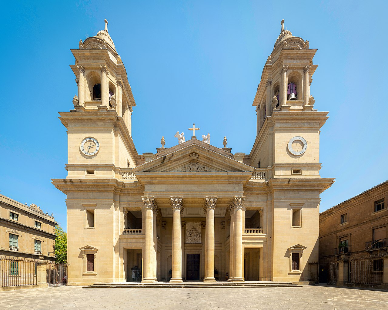
- Pamplona Cathedral (Pamplona/Iruña). Gothic and Neoclassical Catholic cathedral, 14th century. Protection: Bien de Interés Cultural (Spanish heritage listing). Not to be missed.
- Palace of los Reyes de Navarra (Pamplona/Iruña). Palace, 14th–15th century. Protection: Bien de Interés Cultural (Spanish heritage listing). Must-see.
- Church of San Lorenzo (Pamplona/Iruña). Baroque church. Protection: Bien de Interés Cultural (Navarre). Not to be missed.
- Bridge of la Magdalena (Pamplona/Iruña). Must-see.
- Churches of San Cernín (Pamplona/Iruña). 13th century. Must-see.
- Church of Santo Domingo (Pamplona/Iruña). 16th century. Must-see.
- Romanesque church of San Miguel (Cizur Menor). 12th century. Must-see.
- Parish church of San Juan Bautista (Obanos). Church. Protection: part of a World Heritage Site. Must-see.
- Hermitage of San Salvador (Obanos). Must-see.
- Romanesque bridge of Puente la Reina (Puente la Reina). Romanesque bridge, 11th century. Protection: Bien de Interés Cultural (Spanish heritage listing). Not to be missed.
Where to sleep in Puente la Reina
Puente la Reina has 13 places to stay in our guide. All of them, with price, beds and contact details, in the Puente la Reina accommodation finder.
Weather and daylight hours in Puente la Reina
Average temperatures from the Pamplona, Aeropuerto weather station (1981–2010), the nearest to Puente la Reina, and sunrise and sunset times.
| Month | High (°C) | Low (°C) | Sunrise | Sunset |
|---|---|---|---|---|
| January | 9.1 | 1.4 | 08:35 | 17:58 |
| February | 10.9 | 1.6 | 08:04 | 18:38 |
| March | 14.6 | 3.7 | 07:20 | 19:12 |
| April | 16.4 | 5.3 | 07:26 | 20:48 |
| May | 20.8 | 8.6 | 06:45 | 21:22 |
| June | 25.2 | 11.9 | 06:28 | 21:46 |
| July | 28.2 | 14.2 | 06:42 | 21:43 |
| August | 28.3 | 14.5 | 07:13 | 21:09 |
| September | 24.5 | 12 | 07:46 | 20:17 |
| October | 19.3 | 8.9 | 08:20 | 19:25 |
| November | 13.1 | 4.8 | 07:58 | 17:44 |
| December | 9.7 | 2.2 | 08:30 | 17:33 |
The stage with a pet or by bike
In Puente la Reina there are 2 places to stay that accept pets. 5 places to stay store bicycles. Note: a descent averaging 17.0% over 1 km.
The weather in Puente la Reina
Loading the weather…
Data: Open-Meteo · 3-day forecast, for guidance only.