
Camino de Levante
The Camino de Levante is the Camino de Santiago that leaves Valencia and crosses half the peninsula: the Ribera del Júcar and La Costera, the whole of La Mancha, Toledo, Ávila, the Tierra de Medina and Toro to Zamora, where it joins the Vía de la Plata. It covers 799.5 km in 28 stages from Valencia to Zamora, and about 1,192 km to Santiago.
It is a long route, flat almost all the way and very little walked: in 2025, 131 pilgrims reached Santiago on the Camino de Levante and in 2026, up to 11 November, 165, according to the Pilgrim Office. In return, it passes through two World Heritage cities, Toledo and Ávila, the Silk Exchange of Valencia, also a World Heritage Site, and many villages of La Mancha and Castile. In this guide you have the map, the stages, the must-sees, when to go, how to get there, where to sleep and what to eat.
- The stages
- Key facts
- Stages by section
- Must-sees
- When to go
- Getting there
- From Zamora to Santiago
- Where to sleep
- What to eat
- Tips
- Credential and Compostela
- FAQ
The stages of the Camino de Levante
The map shows the route from Valencia to Zamora and below it the 28 stages by section. Tap one to see its route, the villages, what to see and where to sleep.
Tap a point to see the stage; zoom in to see the numbers. On mobile, tap the map to move it. Route: © OpenStreetMap contributors (ODbL).
By distance: up to 22 km 22 to 30 km over 30 km
Camino de Levante key facts
| Fact | Camino de Levante |
|---|---|
| Route | Valencia › Zamora (799.5 km in 28 stages) |
| To Santiago | 1,191.8 km from Valencia via the Vía de la Plata, Astorga and the Camino Francés; 1,203.1 km if you continue along the Camino Sanabrés |
| Average per stage | 28.6 km; the longest, 40.2 km (Albacete › La Roda) |
| Total ascent | About 6,570 m from Valencia to Zamora |
| Highest point | 1,375 m, between San Bartolomé de Pinares and Ávila |
| Places to stay | 161 listed; only one public albergue, in Zamora |
| Double room | €52 on average |
| Asphalt or paved | 36% of the route; 8% on roads with traffic |
| Longest section without a fountain, bar or shop | 39.3 km, between Almansa and Higueruela |
| Longest section without accommodation | 39.8 km |
| Pilgrims | 131 in 2025 and 165 in 2026, up to 11 November (Pilgrim Office) |
| Backpack transfer with Correos | Not available on this route |
The stages of the Camino de Levante by section
The Levante is best understood in four sections: the Valencian huerta, the plain of La Mancha, the sierras between Toledo and Ávila and the cereal fields and vineyards of Castilla y León. The stages are long: eight are over 34 km, so it is worth checking where each one can be split.
From Valencia to Albacete: 8 stages and 226.3 km
It leaves Valencia southwards through the villages of the Huerta Sur, Catarroja, Silla and Almussafes, and continues through the Ribera del Júcar, Algemesí, Alzira and Carcaixent, to Xàtiva. Then it climbs through La Costera, Canals, Vallada and Moixent, and enters Castilla-La Mancha at Almansa, with its castle. The stage Almansa › Higueruela is the loneliest of the route: 38.9 km and a 39.3 km stretch without a fountain, bar or shop. Via Chinchilla de Montearagón, a historic ensemble on the hill of San Blas, you reach Albacete.
From Albacete to Toledo: 8 stages and 249.5 km
This is the La Mancha of straight paths and open horizons: La Gineta, La Roda, San Clemente, Las Pedroñeras, Mota del Cuervo and El Toboso, and then Quintanar de la Orden, La Villa de Don Fadrique, Villacañas, Tembleque and Mora. Here are two of the longest stages, Albacete › La Roda, 40.2 km, and Mora › Toledo, 39.2 km, which ends by entering Toledo.
From Toledo to Ávila: 6 stages and 146.7 km
The landscape changes: from Toledo to Torrijos and Maqueda, with the castle of La Vela, and to Escalona, above the Alberche. Then Almorox and San Martín de Valdeiglesias, the latter already in the Community of Madrid, and Cebreros, in Ávila, wine country. The short stages San Martín › Cebreros and Cebreros › San Bartolomé de Pinares climb towards the highest point of the route, at 1,375 m, before descending to Ávila.
From Ávila to Zamora: 6 stages and 177 km
From Ávila the path descends to La Moraña via Cardeñosa and Gotarrendura and continues to Arévalo, Medina del Campo, with the castle of La Mota, and Nava del Rey. Via Castronuño you reach the Duero and Toro, and the last stage, Toro › Zamora, 36.5 km, follows the river to Zamora.
The 10 must-sees on the Camino de Levante
- Silk Exchange, in Valencia. Other visits: the Rococo palace of the Marquis of Dos Aguas, with its alabaster doorway and the National Ceramics Museum, and the Silk Exchange, a World Heritage Site.
- Almansa Castle, in Almansa. The first town of Castilla-La Mancha on the route, with about 24,600 inhabitants, on the border with Valencia, Alicante and Murcia, dominated by its castle.
- Chinchilla Castle, in Chinchilla de Montearagón. A town with a medieval layout and a listed historic-artistic ensemble, on the hill of San Blas, at 897 m, overlooking the plain of La Mancha; it was capital of the province of Chinchilla in 1822-1823, forerunner of the province of Albacete.
- Church of San Martín, in La Gineta. Its most significant building is the tower and church of San Martín, Gothic from the early 16th century; some manor houses keep their coats of arms.
- Church of San Miguel, in Mota del Cuervo. Church of San Miguel Arcángel.
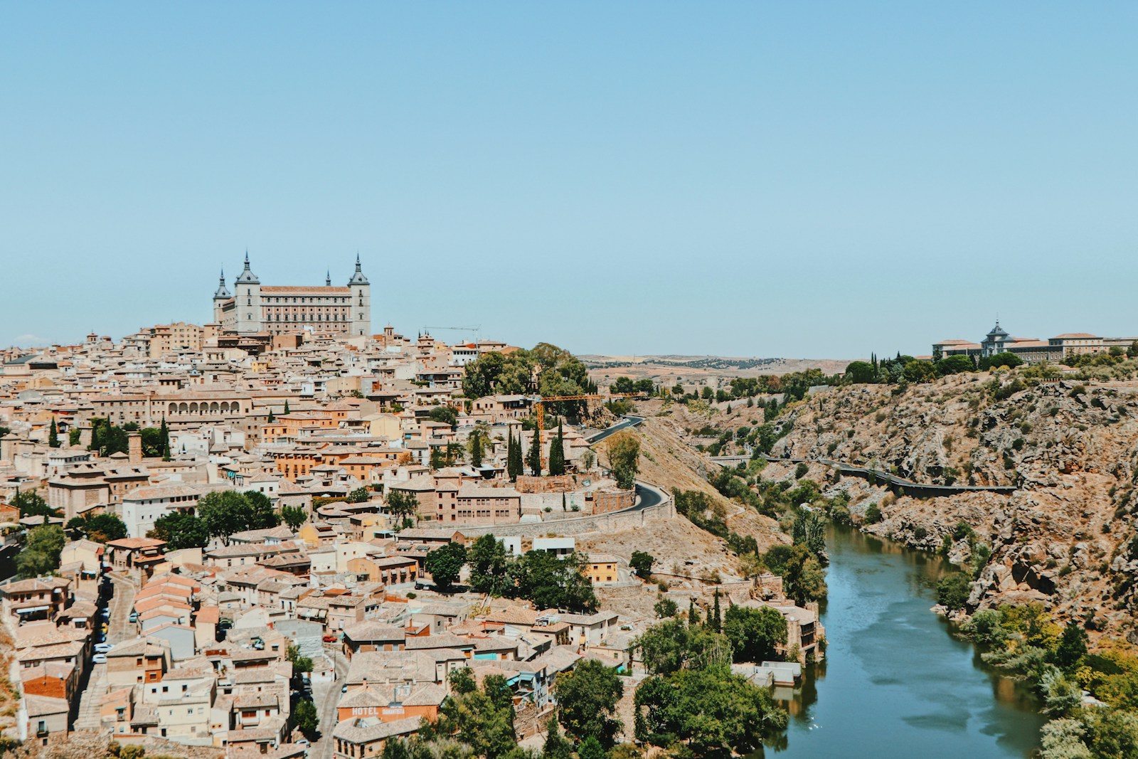
- Toledo Cathedral, in Toledo. It was a great cultural centre of Christians, Muslims and Jews, and its heritage is enormous: the Gothic cathedral of Santa María; the Mozarabic church of San Román and the Mudéjar churches of Santiago del Arrabal and Santo Tomé; the monastery of San Juan de los Reyes, the peak of Isabelline Gothic; the Alcázar, at the very top, home since 2010 of the Army Museum; the castle of San Servando; the Museum-Hospital of Santa Cruz and much more.
- Castle of La Vela, in Maqueda. The town is dominated by the very well preserved castle of La Vela: a Roman lookout post, a Muslim fortress and a 15th-century reconstruction by the Cárdenas family; a historic-artistic monument since 1931, it houses the Historical Museum of the Guardia Civil.
- Basilica of San Vicente, in Ávila. Since 1985 the old city, its walls and the churches outside the walls of San Vicente, San Pedro, San Andrés and San Segundo have been a World Heritage Site; in 2007 San José, Santo Tomás, San Martín, Santa María de la Cabeza and San Nicolás were added.
- Castle of La Mota, in Medina del Campo. Its two great monuments are the castle of La Mota (14th-15th centuries), on a rise overlooking the town and the district, and the collegiate church of San Antolín.
- Zamora Cathedral, in Zamora. Its old town, a listed historic-artistic ensemble, is an open-air museum of Romanesque art, with more than twenty churches: the finest is the 12th-century cathedral, with an original Byzantine-style dome, and the church of Santa María Magdalena.
When to walk the Camino de Levante
The best seasons are spring, from April to mid-June, and autumn, from mid-September to October. In summer La Mancha and Castile scorch: the average high on the route is 31.9 °C in July and 31.4 °C in August, with very little shade and stages of over 30 km. In winter average lows are around 1.1 °C in January and 2.3 °C in December, and between Toledo and Ávila there may be frost or snow.
In 2026 May was the month with the most arrivals in Santiago on the Camino de Levante: 36 of the 165 pilgrims counted up to 11 November. In 2025 the month with the most arrivals was June, with 35.
| Month | Average high | Average low | Rainy days | Arrivals in Santiago 2025 | Arrivals in Santiago 2026 |
|---|---|---|---|---|---|
| January | 10.8 °C | 1.1 °C | 5 | — | 4 |
| February | 12.9 °C | 2.1 °C | 4.7 | — | 3 |
| March | 16.5 °C | 4.2 °C | 4.3 | — | 15 |
| April | 18.3 °C | 6.2 °C | 6.5 | 1 | 17 |
| May | 22.3 °C | 9.8 °C | 6.7 | 10 | 36 |
| June | 28.2 °C | 14.2 °C | 3.5 | 35 | 25 |
| July | 31.9 °C | 17 °C | 1.3 | 17 | 17 |
| August | 31.4 °C | 16.9 °C | 1.8 | 19 | 14 |
| September | 26.8 °C | 13.7 °C | 3.8 | 20 | 13 |
| October | 20.7 °C | 9.5 °C | 6.4 | 23 | 19 |
| November | 14.7 °C | 4.9 °C | 5.9 | 5 | 2 |
| December | 11.2 °C | 2.3 °C | 6.1 | 1 | — |
Temperatures and rain: route averages, using the normals from the weather station closest to each stage end. Arrivals in Santiago: Pilgrim Office (2026, up to 11/11).
How to get to Valencia to start the Camino de Levante
Almost all pilgrims on the Levante start in Valencia. From Madrid there are 15 direct trains a day to València-Joaquín Sorolla station, the fastest in 1 h 54 min (AVE and AVLO). To get back, Zamora has 11 direct trains a day to Madrid, the fastest in 1 h 03 min.
Source: Renfe timetables checked on 12/11/2026. Check those for the day you travel at renfe.com.
If you have fewer days, you can start in Albacete, Toledo or Ávila, which also have train stations, and walk the route in sections. With the planner you choose the starting point and the days you have.
From Zamora to Santiago: how to continue the Camino
The Camino de Levante ends in Zamora, on the Vía de la Plata. From there you have two options: follow the Vía de la Plata to Astorga and join the Camino Francés, with 392.3 km to Santiago, or turn off at Granja de Moreruela onto the Camino Sanabrés, via Puebla de Sanabria and Ourense, with 403.6 km.
The first stage after Zamora is Zamora › Montamarta. From Valencia to Santiago there are about 45 stages.
Where to sleep on the Camino de Levante
We have 161 places to stay listed on the Camino de Levante, including albergues, hostales, guesthouses, rural houses and hotels, but only one public albergue, in Zamora. For most albergues we have no price or opening dates: always phone the day before. A double room costs €52 on average.
This table shows what there is at each stage end. The accommodation finder for the Camino de Levante has them all, with phone number and website.
| Stage | Stage end | Albergues | Bed from | Other accommodation |
|---|---|---|---|---|
| 1 | Algemesí | 1 | — | 3 |
| 2 | Xàtiva | 1 | — | 4 |
| 3 | Moixent | 1 | — | 1 |
| 4 | La Font de la Figuera | 0 | — | 1 |
| 5 | Almansa | 1 | — | 3 |
| 6 | Higueruela | 1 | — | 0 |
| 7 | Chinchilla de Montearagón | 1 | — | 1 |
| 8 | Albacete | 0 | — | 12 |
| 9 | La Roda | 1 | — | 2 |
| 10 | San Clemente | 0 | — | 1 |
| 11 | Las Pedroñeras | 1 | — | 1 |
| 12 | El Toboso | 0 | — | 2 |
| 13 | La Villa de Don Fadrique | 0 | — | 1 |
| 14 | Tembleque | 0 | — | 2 |
| 15 | Mora | 0 | — | 1 |
| 16 | Toledo | 3 | — | 9 |
| 17 | Torrijos | 1 | — | 2 |
| 18 | Escalona | 0 | — | 1 |
| 19 | San Martín de Valdeiglesias | 0 | — | 2 |
| 20 | Cebreros | 1 | — | 1 |
| 21 | San Bartolomé de Pinares | 0 | — | 2 |
| 22 | Ávila | 2 | — | 10 |
| 23 | Gotarrendura | 1 | — | 2 |
| 24 | Arévalo | 0 | — | 2 |
| 25 | Medina del Campo | 0 | — | 6 |
| 26 | Siete Iglesias de Trabancos | 1 | — | 2 |
| 27 | Toro | 0 | — | 5 |
| 28 | Zamora | 2 (1 pub.) | — | 22 |
"—" means we do not have the price. Some places appear as albergues in our data even though they are hostels or guesthouses; confirm the type when booking.
What to eat on the Camino de Levante
The Levante crosses five cuisines: the rice of the Ribera, the sweets of La Costera, the game and shepherd stews of La Mancha, the roast suckling pig of Ávila and the wines of the Duero.
What to eat in Valencia and the Ribera
Rice, olive oil, vegetables and fish. Paella was born as a humble dish of the Albufera, with chicken, rabbit, vegetables and snails (in the Ribera also garrofó beans, pepper and meatballs), and from it come seafood paella and fideuá. All i pebre, an eel stew with potato, garlic and paprika, is attributed to the port of Catarroja and eaten in every village of the Albufera; in Silla, also arròs en perol. In Almussafes, arròs rossejat and sobrasada sandwiches; in Benifaió, oven-baked rice and Christmas olla; for dessert, pumpkin arnadí and sweet potato pastries.
What to eat in La Costera
Xàtiva is the land of oven-baked rice (arròs amb tanda or passejat), soupy rice with beans and turnips and arròs blanquet, and of sweets of Arab origin such as almoixàvenes. In Canals, broad beans with mint; in Moixent, gazpacho with pebrella, game paella, gachamiga, wild mushrooms and almond moixentins, with oil and wine from its cooperative.
What to eat in La Mancha and Toledo
Game and shepherd cooking: gazpacho manchego, migas ruleras, gachas, pisto, atascaburras (egg, oil and cod), ajo de mataero, beans with partridge and caldo moreno, from Albacete to La Roda, also famous for its miguelitos of puff pastry and cream. Las Pedroñeras is the "garlic capital"; in El Toboso, gachas, tiznao, migas with grapes and duelos y quebrantos. Toledo adds Moorish and Sephardic influences: lamb cochifrito, stewed partridge, carcamusas, cheese and marzipan with their own designation.
What to eat in Madrid and Ávila
San Martín de Valdeiglesias has wines already praised by Cervantes, patatas revolconas, arrope and retorcidos; Cebreros, wine with a Protected Designation of Origin since 2017. In Ávila, beans from El Barco, T-bone steak, patatas revolconas, roast suckling pig, hornazo and yemas de Santa Teresa; in Arévalo, the suckling pig is cut with a plate, and at Easter there are rozneques.
What to eat in Valladolid and Zamora
Toro is wine country with its own Designation of Origin, on both banks of the Duero.
Tips for the Camino de Levante
- Split the long stages. Eight stages are over 34 km. Check the intermediate villages with accommodation on each one or use the planner to split the route into shorter days.
- Carry plenty of water. The longest stretches without a fountain, bar or shop are 39.3 km on Almansa › Higueruela; 32.1 km on Toro › Zamora; 28.4 km on La Font de la Figuera › Almansa; 24.8 km on Tembleque › Mora.
- Phone before you arrive. There are few albergues and only one is public: always confirm that it is open and has a bed.
- Avoid summer. In July and August average highs exceed 31 °C and there is hardly any shade in La Mancha.
- Count the daylight hours. In January there are about 9.5 hours of daylight a day and in June, up to 15.2.
- There is no Correos backpack transport on this route. Travel light.
- Prepare the trip with our guides to the first-aid kit, useful apps and what to pack.
Credential and Compostela
The credencial is the document that identifies you as a pilgrim: it gives access to the albergues and is the proof you need to request the Compostela. The official model is issued by the Pilgrimage Office of Santiago Cathedral and can be obtained from parishes, Friends of the Camino associations, albergues and authorised confraternities. More details in our guide to the pilgrim credencial.
For the Compostela you must walk at least the last 100 consecutive km to Santiago (200 km by bike), getting your credencial stamped twice a day on that stretch. Via Astorga and the Camino Francés, the nearest qualifying start is A Pena (Paradela), 100 km away; via the Sanabrés, Ourense. If you only walk the Levante to Zamora, there is no Compostela. It is collected in person at the Pilgrim Office.
2027 is a Compostelan Holy Year because 25 July falls on a Sunday: there will be more pilgrims than usual on the final sections to Santiago.
Camino de Levante FAQ
How many kilometres is the Camino de Levante?
799.5 km from Valencia to Zamora in 28 stages. To Santiago it is 1,191.8 km via the Vía de la Plata, Astorga and the Camino Francés, or 1,203.1 km via the Camino Sanabrés.
How many days does it take to walk the Camino de Levante?
28 days from Valencia to Zamora, at an average of 28.6 km a day, and about 45 to Santiago. With the planner you can spread it over the days you have.
Where does the Camino de Levante start?
In Valencia. According to the Pilgrim Office, everyone who reached Santiago on the Levante in 2025 and 2026 said they had set out from Valencia.
Which is the longest stage of the Camino de Levante?
The one from Albacete to La Roda, with 40.2 km, followed by Mora to Toledo (39.2 km) and Almansa to Higueruela (38.9 km).
Is the Camino de Levante hard?
The climbing is moderate, about 6,570 m in total, but the stages are very long, there are stretches of almost 40 km without services and few albergues. It is a route for experienced pilgrims or those with time to split the stages.
When is the best time to walk the Camino de Levante?
In spring, from April to mid-June, and in autumn, from mid-September to October. In July and August it is very hot in La Mancha and in winter there may be frost between Toledo and Ávila.
Are there albergues on the Camino de Levante?
Few. We have 161 places to stay listed, but only one public albergue, in Zamora. Always phone ahead and check the accommodation finder.
Where does the Camino de Levante join the Vía de la Plata?
In Zamora. From there you continue along the Vía de la Plata to Astorga or along the Camino Sanabrés from Granja de Moreruela.
Can you get the Compostela by walking the Camino de Levante?
Yes, if you reach Santiago on foot and walk at least the last 100 km getting stamped twice a day. If you finish in Zamora, there is no Compostela.
Plan your days with the planner and, on reaching Zamora, continue along the Vía de la Plata or the Camino Sanabrés. To prepare the trip see the practical guides to the Camino de Santiago or compare other routes in all the Caminos.